Madie Ley is a senior art history major, with a minor in history, who received an Art History Department Undergraduate Research Grant to help make this project possible. Madie will present her senior research paper on Friday, May 4, 2018.
The purpose of this research trip was to gain a site-specific perspective on three case studies that are part of my senior paper. My focus is on urban parks built on repurposed railroads—so-called “linear parks”—so I planned to visit the High Line in New York City, the Reading Viaduct in Philadelphia, and the 606 Trail in Chicago. As my paper also looks comparatively at the philosophy and practice of the first park designers in America, specifically that of landscape architect Frederick Law Olmsted, it was also necessary to see two of his most popular parks: Central Park in Manhattan and Prospect Park in Brooklyn.
I set out at each park with a series of questions to answer. How did the design of the park affect my experience on the land? How did other people respond to—or ignore—different design aspects of the park? At Central Park and Prospect Park, I kept in mind the original intentions and design of the park and compared them to how the parks were conserved today, and how Olmsted and his partners Calvert Vaux and H.W.S. Cleveland would react to the current condition of the parks, and the evolution of the surrounding urban landscape.
One of the most important findings of my research trip had to do with the intentionality of moving through each park and how physical movement affected the thoughts that arose while taking in the surrounding landscape.
Olmsted favored creating paths that meandered, turned corners and invited curiosity within a park visitor. What would be on the other side of this bend? His biggest desire with park design was to facilitate a momentary escape into wilderness that was accessible to a working-class urban resident. At Central Park, the sanctuary effect was evident. As a first-time visitor, and someone who was unfamiliar with the area, I abandoned any attempt at trying to keep track of my location within the park, which direction I wanted to go, or where I wanted to end up when I reached urban surroundings again. The curvilinear nature of each path, the diverging walkways and bridges, and the sheer size of Central Park was enough to distract me from any prior expectations of how this visit would go. This phenomenon only compounded when I reached the Ramble, a densely-forested section of the park where small, unpaved footpaths tangled further in on themselves. At times, I was taken by complete surprise with an unexpected rocky outcropping culminating in a point on a pond, or a small valley with twenty-odd birdhouses full of seed and feathered visitors.
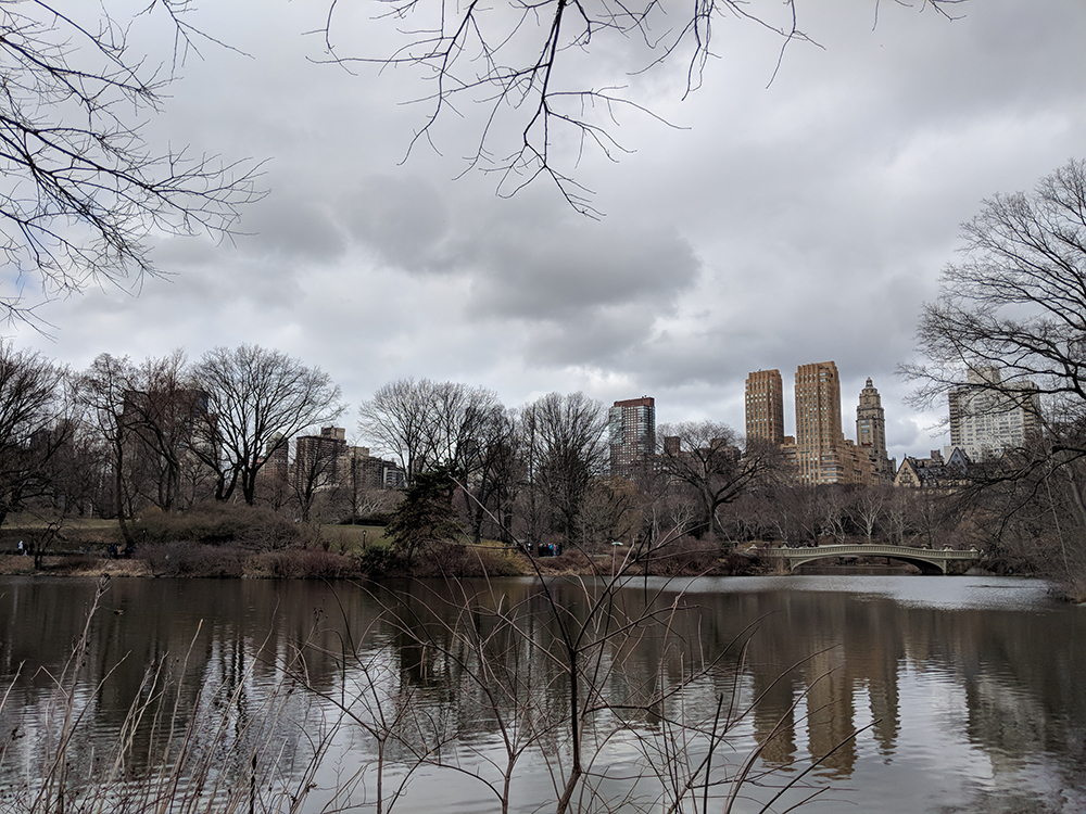
Central Park: View of West border of the park with lake and Bow Bridge in foreground, seen from Ramble overlook.
Later that day on the High Line, I had a similar experience, though it was facilitated by vastly different design elements. The High Line is a park built on an old elevated freight line that was used to deliver goods to warehouses in the Meatpacking District of Manhattan. Since the twenty-first century it has been developed into an elevated park, officially completed in 2014. It is incredibly popular to tourists and residents with a love for postindustrial, urban, and green spaces.
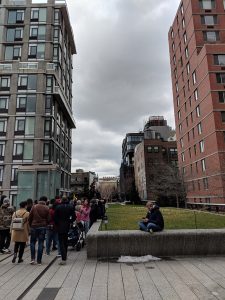
High Line, facing south
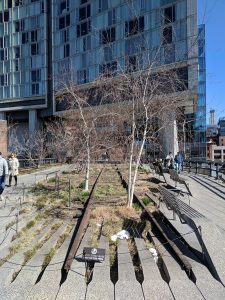
High Line, facing north with the Standard Hotel in background
In terms of the original purpose of urban parks—to create a sanctuary from the density of the built environment—I was certainly enveloped in a mental ‘escape’ from navigating crowded streets and subway stations, suspended ten feet above the street, but Olmsted’s manufactured ‘wilderness’ was far from view. A few plantings of trees, prairie grasses, and shrubbery honored the original wildflowers that had been photographed along the abandoned railroad bed in the 1980s and 90s before this land was developed into the park it is today. A far cry from Central Park’s great boulders and ancient oaks, I was very much still in the city, with apartments, office buildings, and construction projects surrounding me on all sides, at times as close as an arm’s length away.
However, the act of walking a single path, given the only direction is forward, effectively took care of wayfinding for me so that all my mental energy was left to taking in the environment around me. Just like Olmsted’s winding and meandering paths at Central Park eliminated any choice to determine where I would go, the minimalism of a single linear path at the High Line also removed navigation from my mental experience, leaving more space for contemplation and observation of the vertical landscapes around me. I felt similar emotions of wonder and curiosity, but the subjects of my attention were apartment balconies with an assortment of plastic furniture and bicycles, or luxury hotel rooms where one might catch a glimpse of the people who could afford such amenities.
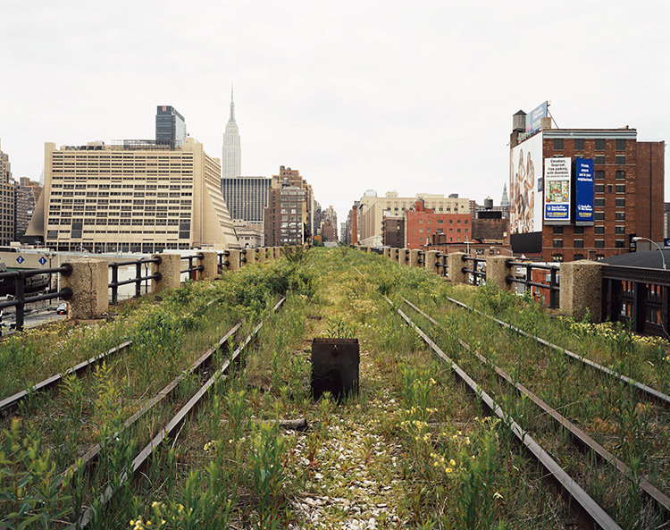
A Railroad Artifact, 30th Street, May 2000 (Joel Sternfeld)
In Philadelphia, I visited the first phase of development along the former Reading Railroad line that goes through the northern part of Center City. The Rail Park takes advantage of a postindustrial environment similar to the High Line, with massive steel structures rising above the railroad, and a variety of elevation within the cityscape: portions of the proposed three-mile park and pedestrian transportation corridor are elevated, at street level, and underground. Much like Joel Sternfeld’s photographs that drew developers’ attention to the High Line, the urban explorer population of Philadelphia have given the Reading tunnel its five minutes of fame on Instagram and photography blogs. The Rail Park is part of a larger High Line Network of parks that echo similar design concepts, ranging from finished projects to proposals in early planning stages, located in urban spaces across North America. “Phase 1” is expected to open in July 2018.
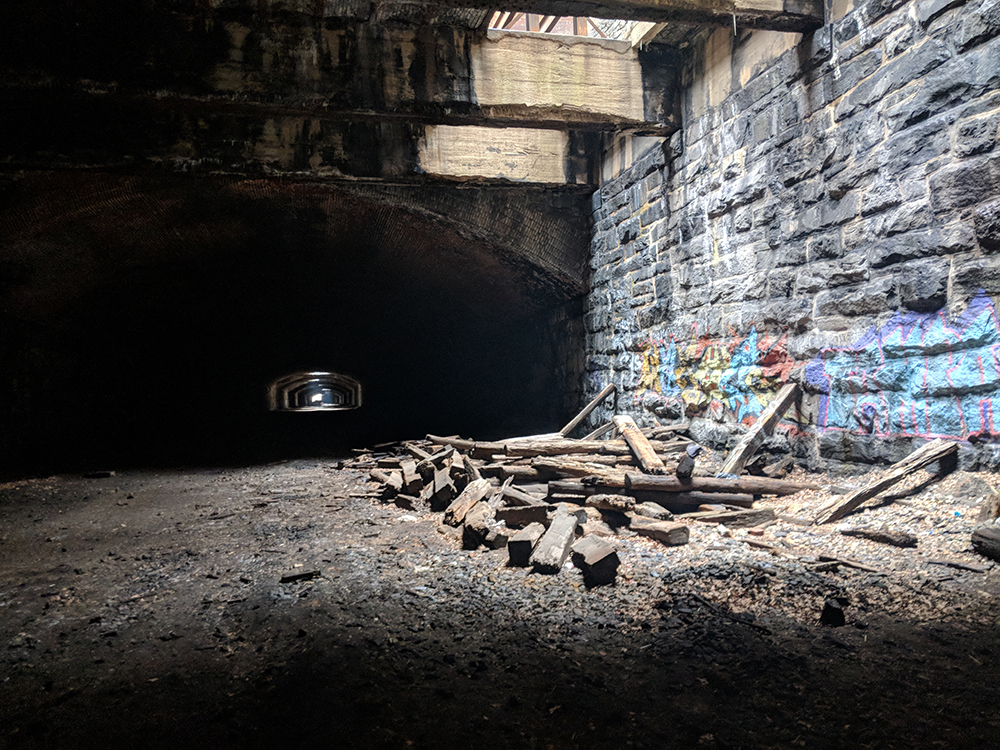
Reading Viaduct Tunnel below Pennsylvania Avenue
My third and final destination was the 606 Trail in Chicago, opened in 2015. Built on the old Bloomingdale railroad line in the Logan Park neighborhood of Northwest Chicago, the 2.7-mile, elevated trail is mostly dedicated to bike transportation, catering to the commuter population that lives outside the city. As opposed to the High Line’s stylized, design-focused path that weaves through trees and exposed rails, the 606 trail is a paved bike path with lane markings, featuring a softer path material on each side for walkers and joggers.
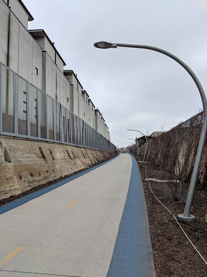
Chicago’s 606 trail near North Kedzie Avenue
—
When it became clear that the Industrial Revolution would quickly take hold in America and land would not be spared, early proponents of the necessity of the natural world feared the fate of urban landscapes, and scrambled to set aside space for parks. In the 1800s, growth moved horizontally across the East Coast and with the development of the railroad industry, further West until the country had been mapped and Native claims to territory had been exploited or ignored. In our current postindustrial state, urban American landscapes have grown vertically to account for the lack of greenspace on the ground. Forward-thinking landscape architects are transforming former industrial transportation corridors into veins of suspended forestry, where pedestrians escape cityscapes via elevation.
